A Road Map of England and Wales in the Late Middle Ages
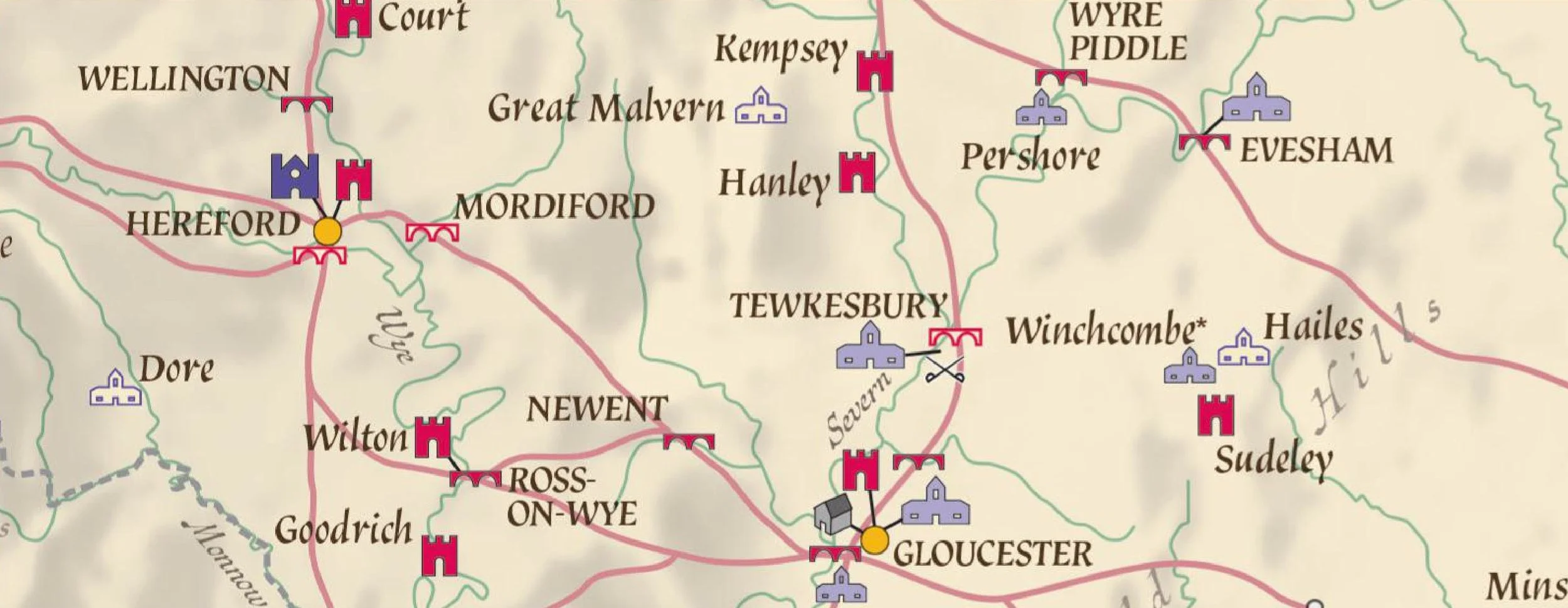
Meticulously recreating the road network of Late Medieval England and Wales for the first time, this new map plots the nation's arteries of trade and communication on the eve of the Tudor ascendancy. As well as major highways and towns, it shows the locations of medieval bridges, commercial inns, castles, great houses, cathedrals and monastic foundations. On the reverse of the map there is a wealth of information on the role of roads and their associated structures, and an extensive gazetteer of where to see surviving examples. It is a must for historians of the period, medieval enthusiasts, and authors of historical fiction.
“A magnificent achievement, the map really transforms one’s understanding of Medieval England.”
“The text on the back of the map is masterful in its compaction and clarity.”
“On a single, large sheet of paper, it shows not only the principal roads of the kingdom, but the bridges that carried them and the cities and major towns they connected. It indicates palaces, major castles and principal monasteries, as well as battlefields (clustered around the two main north-south routes).”
“With explanatory text on the reverse, the map is a distillation of years of research into the medieval records that mention roads, bridges, and causeways as well as their maintenance and repair... All in all, the map shows what an impressive travel infrastructure underpinned late medieval mobility.”